-
Product characteristics
FULL DATA SHEET ON DEMAND
I3500 is an integrated navigation system (GNSS/INS) composed of high-performance MEMS sensors, high-precision GNSS systems and high-performance microprocessors. The built-in self-developed high-reliability integrated navigation algorithm can output the speed, position, attitude and other information of the measured carrier in real time. Users can also externally connect RTCM differential correction data to achieve high-precision RTK positioning. The IP68 waterproof shell-type package can be easily integrated into the user's system. Product model information is as follows:
1.1 Main application scenarios:
I3500 can accurately sense the speed, position, attitude and other information of the carrier, and can complement the advantages of navigation solutions such as lidar (Lidar) and vision (Camera) to enhance the navigation accuracy and reliability of the tested carrier. Typical application markets are as follows:
-
Unmanned Aerial Vehicle (UAV)
-
Robot Navigation Unmanned Vessel (ROV)
-
Smart agricultural machinery
-
driverless vehicles
1.2 Main advantages:
1.2.1 Complete manufacturing system
-
Independently develop automated batch calibration and testing production lines to ensure the consistency of mass-produced products.
-
Small size, embedded design, good product compatibility and high performance
-
Error factors such as zero offset, scale factor, and cross-axis are factory calibrated.
1.2.2 Advanced software algorithms
-
Leading integrated navigation algorithm, can be connected with odometer, DVL and other auxiliary navigation information
-
Can be connected to CORS stations such as Qianxun and China Mobile to achieve high-precision positioning
-
Based on the extended Kalman fusion algorithm, it can still provide continuous navigation information in occlusion environments
1.2.3 High performance sensor
-
Gyroscope bias stability up to 2.5°/h
-
The accelerometer bias stability is up to 30ug
-
Full constellation, full frequency point RTK-GNSS system
1.2.4 IP68 waterproof, CE certified
IP68 waterproof design and CE certification, very suitable for outdoor driverless applications
1.2.5 Convenient communication interface
In order to better embed into user products, I3500 adopts a sturdy and reliable aviation plug interface
1.3 auxiliary development kit:
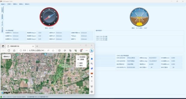
A host computer that can record and display data

| 
 IMU SENSORI (3)
 DRONES (5)
 RADAR SURVEILLANCE (3)
 Security & Defense Technology
 Battery Storage Energy (5)